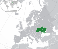
Apamduööt:Europe-Ukraine.svg
Appearance

Size of this PNG preview of this SVG file: 713 × 600 kolook. Tïckatïŋ kɔ̈k: 285 × 240 kolook | 571 × 480 kolook | 913 × 768 kolook | 1,218 × 1,024 kolook | 2,435 × 2,048 kolook | 2,045 × 1,720 kolook.
Makec tueŋ (Apamduööt SVG, yee kolookë ke aayee 2,045 x 1,720, dït de apamduööt: 7.33 MB)
Käthɛɛr ë makec
Tuenyë në aköl/akɔ̈licic apamduööt ɣoi kecit rɔt nyuɔɔth në akölic.
| Aköl/Akɔ̈lic | Riöpbundït | Thëmthëm | Dului | Këcïjaamic | |
|---|---|---|---|---|---|
| ee mënë | 19:19, 12 Pɛnëthiäärkurou 2022 |  | 2,045 × 1,720 (7.33 MB) | Alexassandro | Reverted to version as of 14:22, 11 August 2015 (UTC) |
| 03:18, 10 Pɛnëdiäk 2017 |  | 2,045 × 1,720 (7.34 MB) | Geom10 | fixed disputed borders | |
| 16:22, 11 Pɛnëbɛ̈t 2015 |  | 2,045 × 1,720 (7.33 MB) | Seryo93 | border is suitable for uncontrolled-territory variant | |
| 10:29, 11 Pɛnëbɛ̈t 2015 |  | 2,045 × 1,720 (7.33 MB) | Seryo93 | Second attempt at uploading | |
| 10:24, 11 Pɛnëbɛ̈t 2015 |  | 2,045 × 1,720 (7.33 MB) | Seryo93 | Isthmus of Perekop was too wide. Updated to match File:Europe-Ukraine (disputed territory).svg (except colour, of course) | |
| 18:03, 19 Pɛnëdiäk 2014 |  | 2,045 × 1,720 (2.7 MB) | A.Savin | Reverted to pre-editwar state | |
| 22:06, 18 Pɛnëdiäk 2014 |  | 2,045 × 1,720 (2.71 MB) | Артур михайлович | Reverted to version as of 17:05, 18 March 2014 | |
| 19:06, 18 Pɛnëdiäk 2014 |  | 2,045 × 1,720 (2.71 MB) | Misha motsniy | по примеру с оккупироваными териториями Грузии и Кипра | |
| 19:05, 18 Pɛnëdiäk 2014 |  | 2,045 × 1,720 (2.71 MB) | Misha motsniy | по примеру с оккупироваными териториями Грузии и Кипра | |
| 19:04, 18 Pɛnëdiäk 2014 |  | 2,045 × 1,720 (2.71 MB) | Misha motsniy | по примеру с оккупироваными териториями Грузии и Кипра |
Luɔi ë apamduööt
Cin apaam ye nuët lɔ wëtmätkën.
Luui ë yɔ̈rcïduut de pinynhom
Wiki kɔ̈k bɔ̈ looi makec kënë
- Luɔi be-tarask.wikipedia.orgic
- Luɔi be.wikipedia.orgic
- Luɔi dsb.wikipedia.orgic
- Luɔi en.wikipedia.orgic
- Luɔi fi.wikipedia.orgic
- Luɔi ja.wikipedia.orgic
- Luɔi ka.wikipedia.orgic
- Luɔi lv.wikipedia.orgic
- Luɔi mk.wikipedia.orgic
- Luɔi nn.wikipedia.orgic
- Luɔi rue.wikipedia.orgic
- Luɔi th.wikipedia.orgic
- Luɔi uk.wikipedia.orgic
- Luɔi zh.wikipedia.orgic

