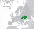
Apamduööt:Europe-Ukraine (disputed territory).svg

Size of this PNG preview of this SVG file: 713 × 600 kolook. Tïckatïŋ kɔ̈k: 285 × 240 kolook | 571 × 480 kolook | 913 × 768 kolook | 1,218 × 1,024 kolook | 2,435 × 2,048 kolook | 2,045 × 1,720 kolook.
Makec tueŋ (Apamduööt SVG, yee kolookë ke aayee 2,045 x 1,720, dït de apamduööt: 7.01 MB)
Käthɛɛr ë makec
Tuenyë në aköl/akɔ̈licic apamduööt ɣoi kecit rɔt nyuɔɔth në akölic.
| Aköl/Akɔ̈lic | Riöpbundït | Thëmthëm | Dului | Këcïjaamic | |
|---|---|---|---|---|---|
| ee mënë | 21:43, 7 Pɛnëdhorou 2023 |  | 2,045 × 1,720 (7.01 MB) | Krestenti | update |
| 03:21, 10 Pɛnëdiäk 2017 |  | 2,045 × 1,720 (7.38 MB) | Geom10 | fixed disputed borders | |
| 14:15, 21 Pɛnëthiäär 2016 |  | 2,045 × 1,720 (7.36 MB) | Giorgi Balakhadze | Disputed areas must be differentiated from rest of the borders | |
| 18:09, 19 Pɛnëbɛ̈t 2014 |  | 2,045 × 1,720 (7.39 MB) | Rob984 | Minor | |
| 22:23, 15 Pɛnëbɛ̈t 2014 |  | 2,045 × 1,720 (7.39 MB) | Rob984 | User created page with UploadWizard |
Luɔi ë apamduööt
Cin apaam ye nuët lɔ wëtmätkën.
Luui ë yɔ̈rcïduut de pinynhom
Wiki kɔ̈k bɔ̈ looi makec kënë
- Luɔi ar.wikipedia.orgic
- أوكرانيا
- مستخدم:ElWaliElAlaoui/ملعب 8
- معاملة المثليين في أوكرانيا
- مستخدم:جار الله/قائمة صور مقالات العلاقات الثنائية
- العلاقات الأوكرانية الأمريكية
- العلاقات الأنغولية الأوكرانية
- العلاقات الأوكرانية الكورية الجنوبية
- العلاقات الأوكرانية الإريترية
- العلاقات الأوكرانية السويسرية
- العلاقات الألمانية الأوكرانية
- العلاقات الأوكرانية الليختنشتانية
- العلاقات الأوكرانية البوليفية
- العلاقات الأوكرانية الموزمبيقية
- العلاقات الأوكرانية البلجيكية
- العلاقات الأوكرانية الإثيوبية
- العلاقات الأوكرانية البيلاروسية
- العلاقات الأوكرانية الطاجيكية
- العلاقات الأوكرانية الرومانية
- العلاقات الأوكرانية الأرجنتينية
- العلاقات الأوكرانية الغامبية
- العلاقات الأوكرانية القبرصية
- العلاقات الأوكرانية السيراليونية
- العلاقات الأوكرانية النيبالية
- العلاقات الأوكرانية الليبيرية
- العلاقات الأوكرانية التشيكية
- العلاقات الأوكرانية الميانمارية
- العلاقات الأوكرانية الكندية
- العلاقات الأوكرانية الزيمبابوية
- العلاقات الأوكرانية الإسرائيلية
- العلاقات الأوكرانية البالاوية
- العلاقات الأوكرانية المالية
- العلاقات الأوكرانية النيجيرية
- العلاقات الأوكرانية اليمنية
- العلاقات الأوكرانية الفانواتية
- العلاقات الأوكرانية الغابونية
- العلاقات الأوكرانية البنمية
- العلاقات الأوكرانية الكوبية
- العلاقات الأوكرانية الجورجية
- العلاقات الأوكرانية التونسية
- العلاقات الأوكرانية الكورية الشمالية
- العلاقات الأوكرانية الهندية
- العلاقات الأوكرانية اليابانية
- العلاقات الأوكرانية الإيطالية
- العلاقات الأوكرانية الناوروية
- العلاقات الأسترالية الأوكرانية
- العلاقات الأوكرانية الزامبية
- العلاقات الأوكرانية الفيجية
- العلاقات الأوكرانية المارشالية
- العلاقات الأذربيجانية الأوكرانية
- العلاقات الأوكرانية السودانية
Tïŋ luui de tëriëcëbɛ̈n juëckɔ̈k de apamduööt kënë.


