
Apamduööt:Political Regions of Sudan - July 2006.svg

Size of this PNG preview of this SVG file: 511 × 600 kolook. Tïckatïŋ kɔ̈k: 204 × 240 kolook | 409 × 480 kolook | 654 × 768 kolook | 873 × 1,024 kolook | 1,745 × 2,048 kolook | 600 × 704 kolook.
Makec tueŋ (Apamduööt SVG, yee kolookë ke aayee 600 x 704, dït de apamduööt: 647 KB)
| Lëkcäät |
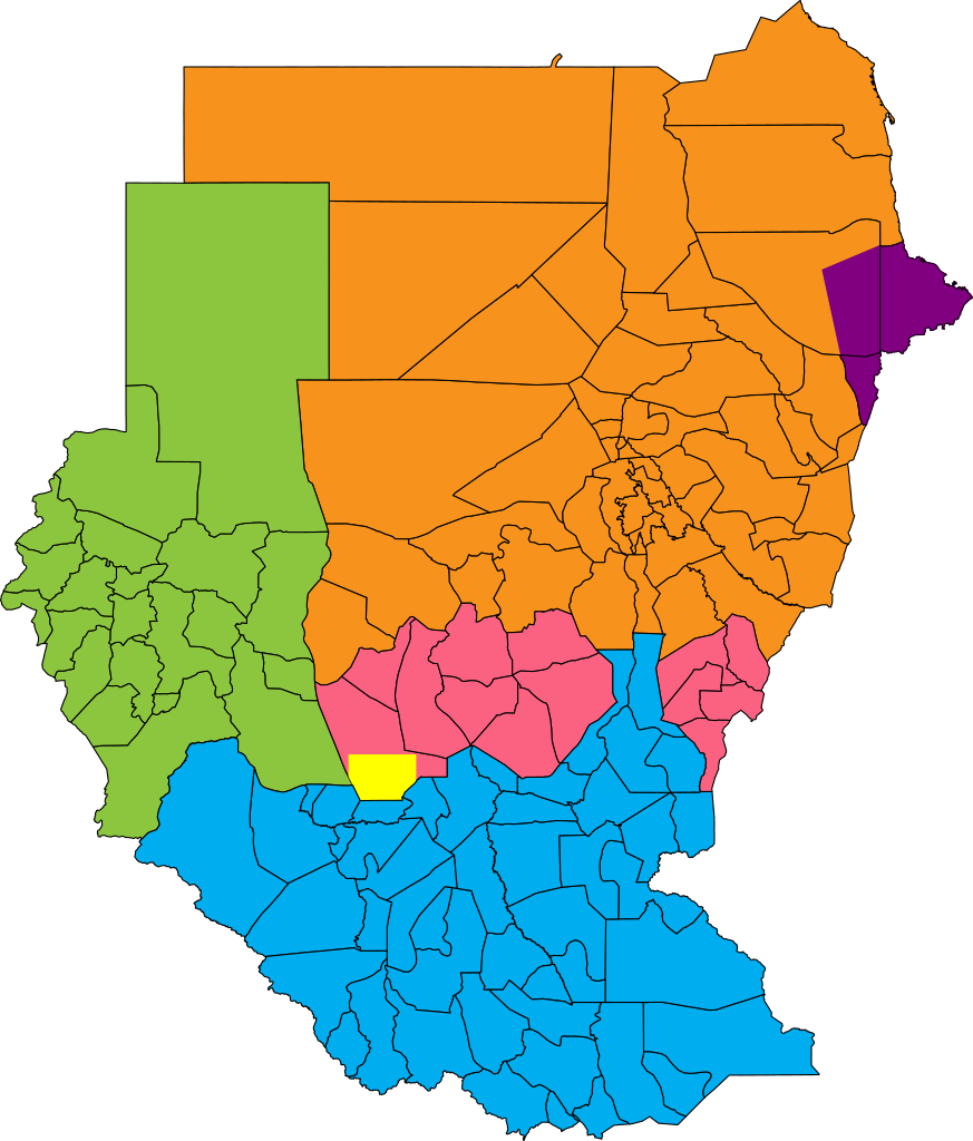
English: Map showing political regions of Sudan as of July 2006.
Darfur
Nuba Mountains and Blue Nile
North Sudan
South Sudan
Eastern Front, area of operations July 2006
Abyei, as defined by the Permanent Court of Arbitration |
| Aköl | |
| Tënëyök |
|
| Agɔ̈t | Lokal_Profil |
| Kithiɛ̈c (Ke ber wëtmätkën looi) |
This file is licensed under the Creative Commons Attribution-Share Alike 2.5 Generic license. Abïcɔl: Lokal_Profil
|
.png)
Käthɛɛr ë makec
Tuenyë në aköl/akɔ̈licic apamduööt ɣoi kecit rɔt nyuɔɔth në akölic.
| Aköl/Akɔ̈lic | Riöpbundït | Thëmthëm | Dului | Këcïjaamic | |
|---|---|---|---|---|---|
| ee mënë | 11:38, 22 Pɛnëtök 2011 | | 600 × 704 (647 KB) | Wiz9999 | Updated borders of Southern Kordofan/Nuba Mountains State as according to http://www.occasionalwitness.com/Articles/20040526b.htm and File:Sudan location map.svg |
| 08:42, 26 Pɛnëdhorou 2009 |  | 600 × 704 (640 KB) | Wiz9999 | The Permanent Court of Arbitration has defined new boundaries for Abyei, which both parties have accepted. Official map: [http://www.pca-cpa.org/upload/files/Abyei%20Award%20Appendix%202.pdf] | |
| 21:24, 26 Pɛnëdhiëc 2008 |  | 600 × 704 (633 KB) | Lokal Profil | Last two features | |
| 20:57, 26 Pɛnëdhiëc 2008 |  | 600 × 704 (581 KB) | Lokal Profil | {{Information |Description={{en|Map showing political regions of Sudan as of July 2006.}} {{legend|#8cc63f|Darfur}} {{legend|#fb6282|Nuba Mountains and Blue Nile}} {{legend|#f7931d|North Sudan}} {{legend|#00adef|South Sudan}} |Source=*Vector map from [[:I |
Luɔi ë apamduööt
Apam thöökë anuɛ̈tke apamduöötë:
Luui ë yɔ̈rcïduut de pinynhom
Wiki kɔ̈k bɔ̈ looi makec kënë
- Luɔi af.wikipedia.orgic
- Luɔi ar.wikipedia.orgic
- Luɔi arz.wikipedia.orgic
- Luɔi ast.wikipedia.orgic
- Luɔi ba.wikipedia.orgic
- Luɔi bn.wikipedia.orgic
- Luɔi bs.wikipedia.orgic
- Luɔi ca.wikipedia.orgic
- Luɔi cs.wikipedia.orgic
- Luɔi da.wikipedia.orgic
- Luɔi de.wikipedia.orgic
- Luɔi el.wikipedia.orgic
- Luɔi en.wikipedia.orgic
- Luɔi es.wikipedia.orgic
- Luɔi et.wikipedia.orgic
- Luɔi fa.wikipedia.orgic
- Luɔi fi.wikipedia.orgic
- Luɔi fr.wikipedia.orgic
- Luɔi he.wikipedia.orgic
- Luɔi hu.wikipedia.orgic
- Luɔi hy.wikipedia.orgic
- Luɔi id.wikipedia.orgic
- Luɔi it.wikipedia.orgic
- Luɔi ja.wikipedia.orgic
- Luɔi ka.wikipedia.orgic
- Luɔi lt.wikipedia.orgic
- Luɔi nn.wikipedia.orgic
- Luɔi no.wikipedia.orgic
- Luɔi pl.wikipedia.orgic
Tïŋ luui de tëriëcëbɛ̈n juëckɔ̈k de apamduööt kënë.